

Paris, France — Europe’s latest weather satellite has sent back its first pictures, offering a glimpse of how future forecasts could become more precise.
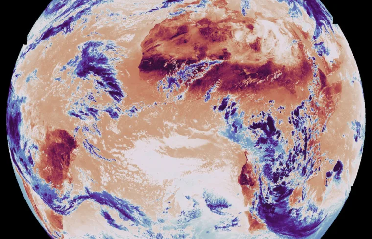
The Meteosat Third Generation-Sounder (MTG-S) satellite revealed two images at the European Space Conference in Brussels. Captured on 15 December 2025 from 36,000 km above Earth, the pictures show temperature and humidity patterns across Europe, Africa and beyond.
One image highlights surface and cloud-top temperatures, with Africa and South America glowing in dark red to mark the hottest regions. The other shows humidity levels, with dry zones over the Sahara and Middle East appearing in red, while wetter areas over eastern Africa stand out in blue.
ESA officials say the mission marks a breakthrough. Simonetta Cheli, ESA’s Director of Earth Observation Programmes, noted the data will “change the way we forecast severe storms over Europe.”
The MTG-S satellite, developed with European partners, is the first of its kind in geostationary orbit to carry a hyperspectral sounder. It can deliver temperature and humidity readings every 30 minutes, complementing cloud and lightning data from its companion MTG-Imager satellite.
Project Manager James Champion called the achievement “a revolution in weather forecasting,” while ESA payload manager Pieter Van den Braembussche said the instrument’s 1,700 infrared channels will soon allow three-dimensional maps of the atmosphere.
With this new capability, meteorologists expect to predict extreme weather events earlier and with greater accuracy, giving communities across Europe and northern Africa more time to prepare.
With this new capability, meteorologists expect to predict extreme weather events earlier and with greater accuracy, giving communities across Europe and northern Africa more time to prepare.


