SHENZHEN, China— Zheng Bo’s team at the Institute of Environment and Ecology, Tsinghua Shenzhen International Graduate School (SIGS) has developed an atmospheric inversion system to infer global wildfire carbon emissions from satellite retrievals of carbon monoxide, investigated the spatial and temporal trends, and driving forces of global wildfire CO2 emissions from 2000-2019.
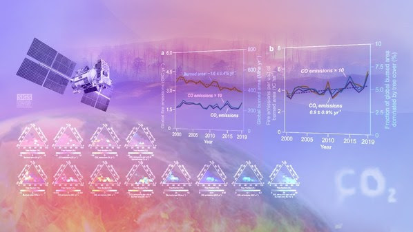
The study suggests that the absence of a rapid, contemporary decline in global wildfire emissions with the burned areas is the increasing forest wildfire emissions.
This study can guide the future development of a global carbon budget monitoring and inversion framework based on satellite remote sensing. Dr. Zheng’s research article, ” Increasing forest fire emissions despite the decline in the global burned area,” has been published in Science Advances on September 24, 2021.

Satellites have detected a global decline in the fire burned areas over grasslands, coincident with a small increase over forests over the past decades.
Bo Zheng and his colleagues developed an atmospheric inversion system to show that global fire emissions have been stable or slightly decreasing despite the substantial decline in the global burned area since 2000, caused by emission increase from forest fires offsetting the decreasing emissions from grass and shrubland fires.
Forest fires are larger CO2 sources per unit area burned than grassland fires, with a slow or incomplete follow-up recovery — sometimes no recovery due to degradation and deforestation.
With fires expanding over forest areas, the slow recovery of CO2 uptake over burned forest lands weakens land sink capacity, implying that pressures from global fires on climate have not been relieved despite the decline in the global burned area.
—(PRNewswire)


