
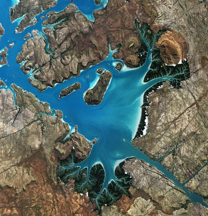

This satellite image over the Kimberley region of Australia captures the Saint George Basin along the country’s northwestern coast.
The basin is a deep harbour connected to the sea by a narrow strait. It is bounded by steep cliffs with large expanses of tidal mud flats and mangroves.
The Prince Regent River flows into the basin from the lower-right corner, and the land north of this river is part of the Prince Regent National Park – a UNESCO Biosphere Reserve. The Aboriginal Worora people are the traditional owners of this area, which is one of Australia’s most remote. It is mainly accessed by air or boat, since there are no roads.
The Japanese Advanced Land Observation Satellite captured this image on 16 June 2009. ALOS was supported as a Third Party Mission, which means that ESA used its multi-mission ground systems to acquire, process, distribute and archive data from the satellite to its user community.
In April 2011 the satellite abruptly lost power while mapping Japan’s tsunami-hit coastline.


